South Dakota: The Oregon Trail, The Black Hills, and A Whole Lotta Rocks

Day 1: Off We Go!
With the truck all packed up, cooler full, and a rough plan for 5 days in the Black Hills of South Dakota, we said our goodbyes to Summit & started driving north. We left around 8am on Wednesday and were looking at a 5.5hr drive to Sheridan Lake — our first campsite for the trip. The drive from Boulder to Custer, SD is primarily open plains and prairie land (including the GIGANTIC Buffalo Gap National Grassland). We wanted to make some stops to break up the drive, but with the lack of mountains and/or trails to stop at along the way, we decided on checking out some historic Oregon Trail sites to break up the drive. We made a quick stop in Cheyenne, WY at a cute bagel shop for some breakfast on the way, which was honestly way better than we were expecting -- a good stage-setter for things to come!
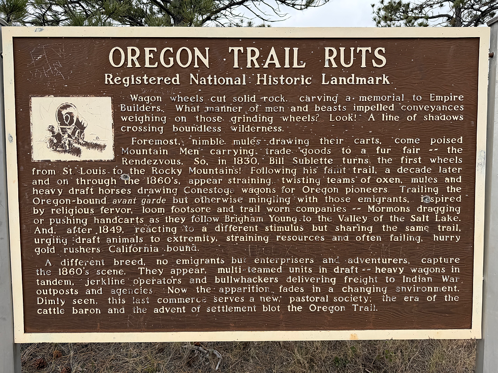
I’ve always been very interested in the history of the Oregon Trail. Emily has been kind enough to listen to my ramblings about that weird, short part of U.S. history many times. Last summer on our Wyoming road trip, she was willing to make a few pit stops for us (mostly me) to see some sites along the original trail. She even got me a book for my birthday last year about two brothers who repeated the trail in an original, fully refurbished wagon in the early 2000s! I have a map on my computer with a whole host of cool sites along the route from Independence, MO to Portland, OR that I’d love to check out someday (what I’d really like to do is bike-pack the route) — Emily was down for checking out a few new ones on our way to South Dakota.
Our first destination was Guernsey, Wyoming. Guernsey sits along the North Platte River, northwest of the town of Fort Laramie. Just west of Guernsey are some of the most well-preserved Oregon Trail ruts in the country! Most of the trail has been lost to time over the past 175+ years, but here you can follow a path through the sandstone where thousands of iron-rimmed wagon wheels wore grooves into the stone, some of which are over 5ft deep. We stopped here and walked around for a while, reading about all sorts of cool historical information of the signs along the trails! It’s a bit underwhelming compared to the mountains & natural scenery we often see in Colorado, but imagining families traveling west over this terrain in the 1850s was pretty awe-inspiring, and it seemed to really encapsulate how desolate & brutal most of the trail was.
Our next stop was just down the road — Register Cliff. This site was one of the major camps along the trail to Oregon, as well as the California Trail and Mormon Trail to Utah, and historians estimate that almost half a million people traveled through this corridor along the North Platte between 1840 and 1860. Fort Laramie (just a bit further east) was considered the point where travelers truly entered the “American West”, and Register Cliff holds a big piece of that history. After leaving Fort Laramie fully restocked on supplies, food, and clothes, people would camp here a few miles further along the river. The cliff holds thousands of signatures and dates carved into the rock — some left as messages for friends or family following behind, others just to leave some remnant of their passage behind as proof. There are names & dates that go as far back as 1797! Unquestionably the oldest proven remnants of white Europeans from the east coast exploring this region, most likely trappers involved in the fur trade. We wandered around for a while watching the cliff swallows fly in & out of their nests to feed their babies, looking for the oldest signatures we could find. I got pooped on twice by the swallows — my own fault for standing directly under their nests staring at the wall…
Before we continued on, we stopped along the river at the site of a Pony Express station. Although the Pony Express essentially only lasted 1 year, the route from St. Joseph, Missouri to Sacramento, California was a major success (and very badass). In that year, 120 different riders delivered mail between these cities, riding a combined total of 650,000 miles and only losing ONE piece of mail! And only one late delivery. Pretty impressive stuff for high-speed horse travel in the 1860s. Unfortunately (or fortunately?) the Pony Express had a short life. Western Union completed the Transcontinental Telegraph in 1861 and high speed communication from coast to coast become much easier, no longer requiring the extreme skill, high levels of danger, and overall fairly absurd (though awesome) methods of the Pony Express.
Next, we went another ~15 miles east to Fort Laramie. This location has a very complicated & very involved past, and I honestly don’t know 90% of that history. What I do know and what did learn was pretty awesome though! It started as a fur trading post in 1834 and quickly became a major hub and stopover point for westward travel. It was the primary place where travelers repaired wagons, resupplied on food & supplies, and received news from the east. By the late 1860/70s, it had been fully taken over by the U.S. army — it was used as an outpost, base camp, armory, and true “fort” during many of the clashes and battles with Great Plains tribes. Today, the site is in unbelievably good condition. Many buildings fully restored, original canons & wagons on site, and plenty of rooms full of original clothing, weapons, tools, machinery, and so much more.
Some of the buildings and structures here are incredible! Being such a well maintained site has required decades of construction, and it has undergone some serious renovation to bring it back to this condition. One of our favorite buidings was “Old Bedlam”, the oldest standing building in Wyoming. Apparently it was used as housing for the boisterous bachelor officers in the army, and was full of drinking, gambling, and a whole lot of chaos. We checked out the trading post, which still has the original wooden countertops in one room! Some other highlights were the various wagons and ox carts all around the site, the cavalry quarters (GIANT building full of cots & a big mess hall), and the two jailhouses. To be honest, I’m not very into military history, but the combined history of this place as a fur trading site, Oregon Trail town, and army outpost was pretty awesome to learn about.
Once we’d had our fill of sign-reading & wandering around, we hopped back in the truck for the final 3 hours to the Black Hills. Not much to mention from this part of the drive other than the fact that Wyoming is EMPTY. Very beautiful landscapes up there, but wow it's seriously flat and endless. Eventually, the landscape started to change — ponderosa pines started to appear, the road started to wind a bit more, and rock outcrops were coming into view. It was a pretty grey afternoon at this point, and as we entered the town of Custer it was lightly raining. After a quick gas-up and a slow drive down Main Street, we continued on to Sheridan Lake, passing the in-progress Crazy Horse monument on the way!
Pulling into the campground, we knew we’d lucked out. We’d booked some campsites fairly last-minute and didn’t have many choices — I was a bit worried that the spots wouldn’t be very cool because the “best” campgrounds were all full. Sheridan Lake is awesome! The campground is right along the lake shore spread throughout the ponderosa pines. The smell stepping out of the car was amazing — the vanilla scent of the pines, the slightly lake-y smell from the cattails, and wet rain on the tall grass… pretty awesome spot to pull into. We bought some fire wood from the campground host & went to find our site.
The sites at Sheridan are perfect. They’re very spread out & each one has plenty of flat, grassy space to set up. We borrowed mom & dad’s tailgate tent thing since the forecast had some rain. We were pretty excited to settle in for a cozy camp evening and set everything up right away! After a little snack break, we set out for a walk to explore the campground and lakeshore a bit. The post-rain moody weather was seriously awesome. It felt like the grey skies were making the colors pop — the wet, green grass & reeds along the lakeshore were glowing. We saw an osprey and some turkey vultures, a bunch of people fishing, and had a nice chat with the campground host, Heidi, who was out walking her little terrier named Molly (who promptly puked after eating too much grass lol).
We wandered back to camp and decided to get dinner going. The first dinner was a simple classic: “slop”. This name was coined by Isaac, who invented the dish, and it’s honestly great. I diced up a sweet potato, one carrot, half a red bell pepper, and half an onion to sauté. Once these were nice n crispy, we added some Trader Joe’s madras lentil curry. That’s it. The simple, yet satisfying slop. It tastes good, it’s easy to make, and it’s healthy. Even better when eaten with tortilla chips! Post-dinner we went for another short walk, started a fire, and pretty much just chilled by the fire reading & chatting until it was time for bed. On the whole, day one was a success and we were looking forward to the days to come!
Day 2: Outlaws, Saloons, and The Needles Highway
We woke up in the tent after a pretty solid night’s sleep sometime around 6:45am and unzipped to see what the day looked like. The forecast had shown a chance of rain from basically 7am-9pm on this day (Thursday), so we had low hopes for the day as far as outdoor activities go. We decided it’d be best to do the more car-centric things today & hope for dry weather. The plan was to head 30 miles north to the town of Deadwood and see where the day took us from there!
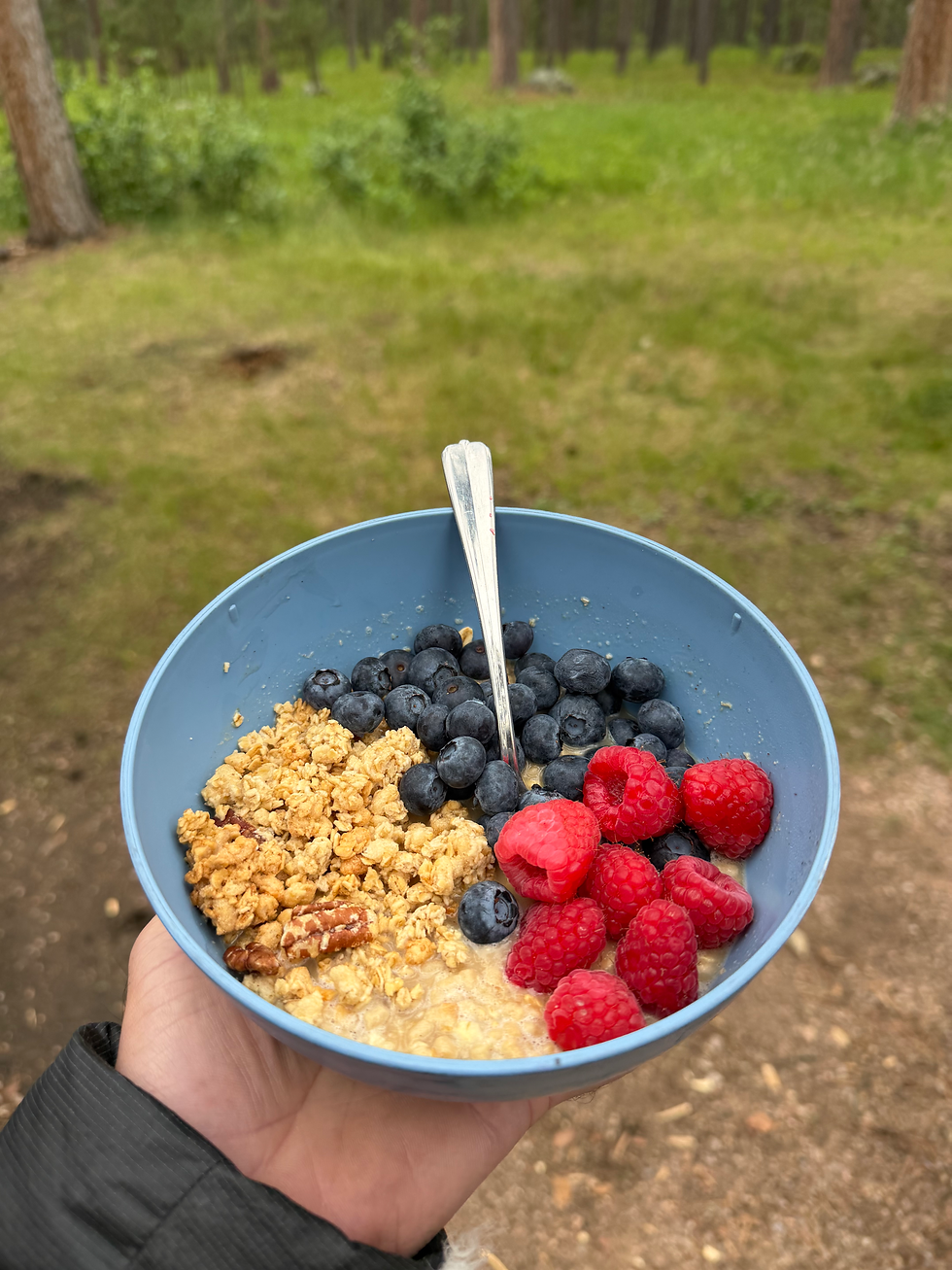
Luckily, things were dry & calm when we woke up! A bit overcast and moody, but a perfect temperature and no wind. I started making my coffee while Emily started gathering her clothes and shoes for a morning run. She’s training for a 50 mile race right now — NO REST DAYS! I, on the other hand, was looking forward to having a slow morning reading & drinking coffee. After a little snack, Emily went off in search of the Centennial Trail near the east side of the lake and I grabbed my camera to go for a little lake walk to look for birds. Saw some ospreys, many great blue herons, and a whole bunch of turkey vultures, but it was a quiet morning on the lake. Emily eventually made it back after 4 or 5 miles and we got a quick breakfast going. Simple oatmeal, granola, and some berries — although I can’t seem to stomach oatmeal at home, it really hits the spot while camping.
With breakfast down & some miles run (for Emily) we hopped in the truck and headed north. Deadwood was a town I'd really been looking forward to checking out, and Emily too. I didn’t know too much about the history of the town other than that it was established by a bunch of outlaws way back in the 1800s on tribal land, where it wasn’t subject to U.S. law. The name makes me think of Butch Cassidy, gun duels in the streets, rowdy saloons, and a whole lot of crazy miners. Although the town is now mostly a tourist destination, those thoughts are pretty much accurate to what Deadwood once was.
The town sprang up in early 1876 as a gold rush town, and was not long after described by a traveler who’d headed back east as “the most diabolical town on Earth”. It wasn’t just created & run by outlaws, it was a full-on outlaw enterprise — outside of U.S. governance, law, and territory (and full of gold, liquor, guns, and gambling), it was an outlaw’s paradise. In its early days, Deadwood was a rough-and-tumble boomtown where "laws" weren't really enforced & larger-than-life characters like Wild Bill Hickok and Calamity Jane were staples of local lore. The saloons, gambling halls, and mining claims lined the muddy streets as people chased dreams of striking it rich. Gold, crime, and seriously rapid growth shaped the town’s early years, creating the (sometimes ridiculous) history that is still so fascinating today. More than just a gold rush town-turned-city, Deadwood offers a look into a unique chapter of frontier America where fact and fiction seemed to become one and the same.
Our first stop as we pulled into town was a cute little bakery/coffee shop, which was also a glass blowing studio — I got a second coffee and Emily got a matcha. We walked around with our drinks checking out the scenery & intricate old buildings. The town sits way down in a fairly steep valley right along a creek. Due to this topography, the town is long and skinny, stretching along the creek with one busy Main Street & only a few side streets. One of my favorite stops on our walk was Saloon No. 10. Since it was 10:30am, we weren’t in the mood for drinks, but the place was awesome. Hundreds of old photos of the people, scenes, and buildings of Deadwood back in its prime. One cowboy-looking old guy at the bar. Sawdust for a floor. Very cool place.
Another sweet stop was a gift shop that had an absolutely insane model train on one floor. The whole setup was probably 10ft wide and 40ft long, with an unbelievable amount of detail -- over & underpasses, different types of forests, multiple neighborhoods, and probably a dozen train lines. After passing about 25 more saloons and a few old hotels, we made it over to the Adam’s Museum. This is one of the older buildings in town and was converted to a museum sometime in the 1960s (I think). This was definitely a worthwhile stop — all sorts of cool artifacts, stories, and details of the history of the town, and the Black Hills in general. An old train, 1800s rifles, gold nuggets, clothes, original furniture, and tons of maps & photos.
Once we’d had our fill, we went for a nice walk along the creek to the trailhead for the Mickelson Trail. This trail extends 109 miles to the southern end of the Black Hills and seems like an awesome out & back bike-packing adventure. We just walked for 10 or 15 mins to check it out before heading back to the car. The weather was still gloomy, so we decided to stick with our driving-heavy plan instead of doing a long run or climb and getting stuck in the rain. We started driving back south with the plan of driving a famous loop — the Iron Mountain Road to the Needles Highway.
On the way to the Iron Mountain Road, we drove through the town of Keystone. Our campground host had told us we HAD TO check this place out. As we drove through, we realized this was not a place we wanted to stop. It was a chaotic scene from tourist heaven — taffy shops, photo booths, a roller coaster, zip lines, people crossing the street everywhere without looking. I’m sure it’s a fun stop, especially with kids, but we were ready for some rocks & views & epic nature scenes, so we continued on. Iron Mountain Road is pretty historic — the road winds through some ridiculous terrain and includes some really old (and really tight) tunnels, fully wooden bridges, and 2 wild loops where the road circles up & around the road below to avoid steep cliffs. We eventually made it to the summit & were treated with a perfect view of Mt. Rushmore from across the valley! Definitely worth driving this road, as long as your vehicle fits under the 10ft height limit and 9ft width limit.
We were pretty hungry at this point, so we made parking lot sandwiches at the summit — these were some of the best ones we’d made! After lunch, we headed down the other side of the mountain to Playhouse Road, which we used to cut across to the Needles Highway. I’d seen photos of the tunnels, spires, and steep cliffs of the Needles Highway before, but holy moly it was WAY more amazing than I expected. This section of road goes directly through the most jagged and steep sections of the Black Hills — I have no clue how they were able to build this thing. It's truly mind-blowing. We made a whole bunch of short stops, pull offs for photos, and pretty much just stared out the window for 30 mins saying “that’s insane!!” every few seconds when new rock spires came into view.
After plenty of stops & viewpoints & photos, we eventually made it out of the most rocky parts and found ourselves at Sylvan Lake. This lake was one of Emily’s #1 priorities to visit — paddle boarding, swimming, access to the Cathedral Spires, and just an overall incredible spot. We parked at the lake and, although it was quite windy & a bit cold, went for a walk out to some sweet rocks in the water. Sylvan isn’t a natural lake. The dam that was built created this crazy spot with crystal clear water & the tops of rock spires sticking out, clearly once a valley of spires similar to the ones we'd been seeing all day. But with this one, you could only see the tippy tops. It’s very unique, and we were excited to come back over the next few days when the weather was better.
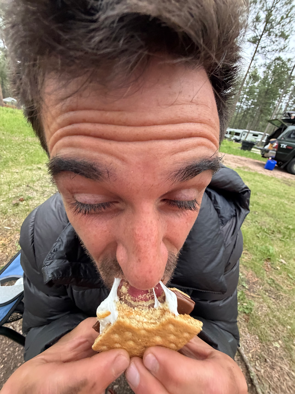
On the way back to the campground from Sylvan, we made a quick stop in Hill City for some snacks & s’mores supplies. Back at camp, Emily took a nice little late afternoon nap while I read a bit & prepped some veggies for dinner. Once she was up, we had our classic brats with peppers & onions for dinner. An easy, delicious, and honestly perfect camping dinner. With a bagged salad as well for #health. With dinner done & dishes clean, we got the fire going and carved the ends of some nice sticks that Emily found. Gotta have the perfect marshmallow roasting stick, even if it takes some time. We roasted mallows, ate s’mores, and read a bit before slinking away to the tent for a very early bedtime. We were pretty tired from the day, and the sleep came quickly.
Day 3: Climbing Rocks & Floating on Lakes
The forecast for Friday was much better than previous days, and we were psyched to make the most of it! Due to a very loud squirrel & some active crows, we were up and at ‘em around 6am. I am a creature of habit (sometimes to a fault), so I need a solid 45mins-1hr of sitting, reading, and drinking coffee (thanks for the patience @emily). This is usually fine, but on early mornings it tends to mean an even earlier wake-up time for me. After the coffee and reading time was done, we broke down camp and packed the truck up. Our two nights at Sheridan Lake were amazing, but we were moving to Bismarck Lake tonight for the rest of the trip. Bismarck is a bit closer to the town of Custer, Mt. Rushmore, and Sylvan Lake, so we were looking forward to the ease of access and minimal driving through the weekend!
We wanted to get some climbing in during our time here, as the Needles region near Rushmore is ultra-famous in climbing history. And after seeing so many ridiculous spires & boulders & cliffs yesterday, I was pretty excited to check it out. As with any new climbing area, it’s hard to know where to go when you have limited time. This areas has thousands of routes, so our choices were endless. We settled on an area in the heart of the Needles called the South Seas. It has an impressive density of rock and grades ranging from multi-pitch 5.4 spire climbing to hard 5.13 sport climbing. In short, it was the perfect spot for our one-day climbing outing.
It was a quick & easy drive from camp, and we pulled into the Old Baldy parking lot with not another soul in sight. We didn’t really know exactly where to go — this place is a wildly complicated maze of spires, boulders, and hills. Eventually we found ourselves at the base of a rock with bolts, which we quickly identified as “The Hornet’s Nest”. This was one of the areas we were hoping to find — perfect! We found a sweet 5.6 to try first, which went to the tippy top of a skinny spire. This was when we realized this place might be extremely sandbagged (meaning the routes tend to be harder than their proposed grades). The first bolt was 25ft high and I definitely did some 5.8/5.9 climbing to get to it… fun, but a rude awakening.
After that, we found an incredible, super long 5.8 to the top of an even taller spire! Following the pattern, this one felt like 5.10a — it was seeming every route was roughly 2 letter grades harder than what we were used to. Next, a wildly cool 5.11b which followed a band of giant quartz crystals! I’ve never climbed anything like it, and it definitely felt 5.12 lol. We snacked a bit after this, explored the sub-canyon we were in, and found a really awesome 5.10+ to climb next. This thing was AWESOME! A funky, steep start for 6 bolts into a very thin and runout (read: scary) additional 7 bolts to the top. The views from the top of these climbs were nuts! Spires of rock jutting out everywhere as far as the eye can see.
At some point we decided it was time to go find some water to jump in & a place to eat some lunch, so we hiked back to the car to head for Sylvan Lake once again. At Sylvan, Emily took a quick nap while I wandered around, dipping my feet in the water and eating some summer sausage. I found a piece of chocolate cake for sale in the Sylvan general store, which I bought and stuck into the back of the truck for Emily later. Once she was awake, Emily joined me for some more walking & testing of the waters. There were so many people at the lake — a super fun scene, but we were ready for campground hanging & some quieter waters to dip in. So we hopped back in the truck to head for our new campground at Bismarck Lake!

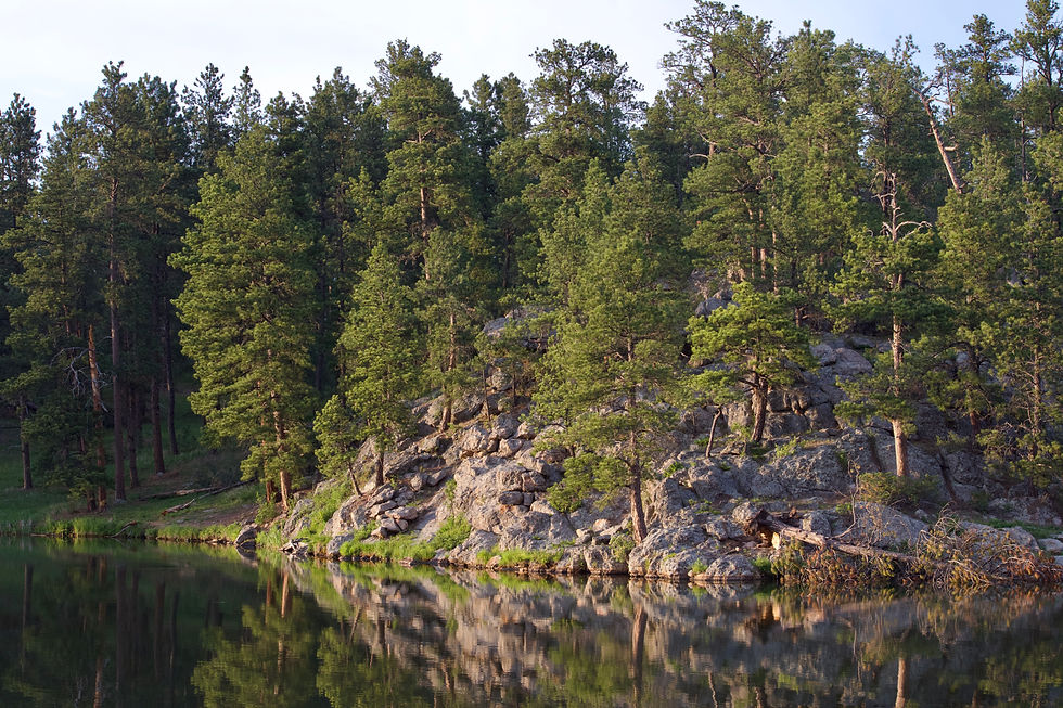
We didn’t know what to expect from this site, since we’d booked it pretty last minute. As we took the left turn for our campground, a huge lake (Stockade Lake) was on our right & had a few paddle boarders & kayakers out and about. We took this as a good sign. The campground was way smaller than Sheridan Lake, and WAY prettier!! Our site was massive — space for the tailgate tent, our sleeping tent, a separate area for the table, and it was all overlooking Bismarck Lake and surrounded by huge boulders! We were stoked. Upon pulling in, Emily immediately led us out to a sweet overlook deck with benches just down the hill from our spot. The lake was perfect. Calm water, only a few people around, and absolutely stunning scenery. Tall reeds & cattails along the shore, huge ponderosas on the hills surrounding, and plenty of spires & unique rock features poking out of the trees. We seriously lucked out finding this place.
After a quick setup of camp, we packed a bag for the water. Towels, sunscreen, a tube, and not much else. We went down to walk along the shore just below our campsite, but decided it was a bit too lake-y (AKA muddy, planty, and a bit seaweedy) — instead, we popped on over to Stockade Lake just across the road. This turned out to be a much better spot for actual water sports & swimming, with a sweet little beach right on the northern shore closest to us. We blew up the tube & Emily floated on out (with a White Claw poured into her water bottle, of course). This was a much needed rest time after a fairly busy few days, so Emily floated around for a while and I waded alongside in an attempt to get a natural bath out of the lake visit.
Once we’d had our fill of floating, we drove the loop around the lake in search of other cool spots. At the end of the loop we found a nice secluded spot for a final dip & hopped back in. The area was a birders paradise. Four ospreys were constantly zooming around, diving in & catching fish. We saw about a million great blue herons too, some of which seemed to be either fighting or mating, flying very close to us screeching at each other. At this point, I think we’d had just about enough of the sun for the day and were feeling quite tired & ready to settle back in for an evening at camp. We needed to hit a grocery store for a refuel, but decided to push it back to tomorrow & opted for a pizza dinner instead.
In Crested Butte a few summers ago, we decided that getting a massive take-out pizza, from the best local spot in the nearest town, and bringing it back to your campsite is one of the best ways to spend an evening. Plus a handful of alcoholic beverages to go along with it. Emily found a cute spot in Custer, only ~10 mins away, which had great reviews and we decided to swing on by. We put in an order & walked over the market across the street to grab some ice for the cooler while we waited. By the time it was ready, we were itching to get “home” and have a relaxing evening. Back at camp, we set up under the tailgate tent & went to town on the pizza. Pretty solid for a tiny little spot in Custer, South Dakota — would definitely eat again.
After stuffing ourselves with pizza, it was GAME TIME! Emily is very good at making sure there’s something to do when you’re out in the woods. Whether that’s the “going on a picnic” word game, the alphabet game while driving, or prepping by bringing 12 different card/board games on a camping trip, she’s got it covered. This night, we opted for the portable Catan game. We’d played a few times before, but I forgot how fun it is! It’s a very simplified version of the actual Catan board game (resources, roads, all that good stuff), but can truly fit in a pocket. Emily absolutely destroyed me… After some dice rolling and resource sharing, we did a little more reading time, just sort of hanging out in the perfect evening weather.
After a while, we could see a storm start building to the west. It wasn’t supposed to storm, but the wind was picking up and it DEFINITELY looked like rain was coming. While Emily went to the car to grab some stuff, the wind started really whipping — I sped to unzip the tailgate tent “roof” and bug tent, as it was starting to get some air. Our camp neighbor Kevin, who we’d met early, came over to help me take it down while Emily was away (shoutout Kevin!). Within a handful of minutes lightning was striking across the lake and we were rushing to get out things put away. We got everything cleaned up just in time for the rain to hit & we scurried into the tent. I love summer thunderstorms SO much, so I was honestly pretty excited to drift off to sleep in a small gale.
It was, realistically, way too early to go to sleep (7:30pm), but the rain was coming down and we were all bundled up in the tent listening to the thunder & wind & rain. Emily drifted off pretty quickly, but I stayed up a bit longer twiddling my thumbs & reading on the kindle. Eventually the storm subsided enough for the tent to stop flapping around, and I drifted off too. On the whole, it was a pretty amazing day. Climbing, multiple lakes, pizza, a classic summer storm. The kind of day that makes me wish I could do little road trips like this more often to see more of the country in this way.
Day 4: Another Classic "this is our favorite run EVER!" Kind of Run
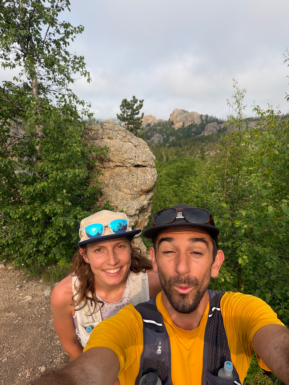
After a night of on & off rain, we awoke to calm and fairly clear weather! I didn’t sleep very well with the stormy happenings all night, but Emily clocked a solid ~10 hours. After a classic and oh-so-peaceful coffee and reading time in camp, we hopped in the truck to head back to Sylvan Lake. I’d mapped out a cool looking run before the trip — starting at Sylvan Lake: summit Little Devil’s Tower, then pop into the Cathedral Spires to an overlook, with the final & furthest point of the loop being Black Elk Peak (highest point in the U.S. east of the Rockies!) before heading back south to Sylvan. I hadn’t looked at photos or details of the trails, but it looked sweet from the maps so we decided to go for it!
We found a spot in the Sylvan parking lot, did a quick change into running clothes, packed some water & snacks in the running vests, and started up the Little Devil’s Tower trail. From the first steps, the trail was stunning. Cool temperatures, neon green grass, aspens, and a nice low fog around the rock spires felt perfect. We started gaining elevation pretty quickly & before we knew it, we had some amazing open views back towards Sylvan. We weren’t sure if we wanted to add Little Devil’s Tower since it was an out & back offshoot from the main loop, but we passed a nice couple who’d just come down and they said it was 1000% worth it! So when we hit the left turn, we took it and started cruising towards the summit. The final bits to the top were awesome — scrambly & rock-hoppy with ridiculous views of the Cathedral Spires, the Needles, and Black Elk Peak! We spent some time on top ogling the scenery, taking photos, and generally talking about how South Dakota has blown our expectations out of the water.
After soaking in the summit, we worked our way back to the main trail and continued on in search of the Cathedral Spires offshoot. Before long, we found it & started descending down into a crazy cool, hidden little valley between the spires. The rock features in this area are nuts. So many balanced boulders, arches, towers, and skinny spires sticking 100s of feet into the sky. This section REALLY made me want to come back here again to do more climbing. It’s hard to see so many spires like this and not wonder what it’d be like to be standing on top of one. Once we’d had our fill here, we went back up the steep climb to the main trail and continued on towards Black Elk Peak. From the top of Little Devil’s Tower, we got a sweet view of the peak and realized there was a lookout tower of some sort on the summit. We had no idea that was there & were excited to check it out.
The trail to Black Elk was great — cruiser single track, slight uphills, and amazing views in all directions. As we neared the summit, we started seeing a lot more people — it seems like Black Elk is very popular, but that it isn’t typically done via the route we took. The final section to the summit was a wild surprise! Steep steps, some steel bridges spanning gaps in the rock, and little stone walls that had fallen into disrepair. As we neared the top, we found ourselves way up on a rock ridge with a winding stone path, leading straight to the tower. This was such an incredible summit — you can walk up to the top of the old tower & get a full 360 view of the entirety of the Black Hills. With no peaks nearby that are close to this height, you can see to the horizon in all directions — something that seems fairly rare back home in Colorado.
We explored the tower a bit before finding a nice spot out on the rocks for a snack. There was another weird tower down by a damned up little pool of water. I don’t know the history & want to learn more, but our best guess was that this water reservoir was made by/for whoever manned this fire tower whenever it was in use. Pretty smart thinking. After snacking & working a way past a bunch of shirtless dudes wearing jeans & camo hats, we were off on the descent back to Sylvan. The descent went by quickly — mostly fun & cruiser downhill, with a few little bumps back up. Before long we were back at the car drinking ice cold lemonade and changing into something we could swim in!
We found a nice spot to hop in the lake back at Sylvan and, after 10+ minutes of being afraid of the cold, both dunked & washed ourselves off. We were pretty crusty at this point, especially after the run, and the cold lake was much needed for physical and mental cleansing. Once we felt sufficiently clean & cold, we found a great spot way up on a rock rib to lay down our towels — I was ready for a nap, but Emily decided to keep cranking through her book. Tony gave her his copy of Dungeon Crawler Carl last week and she’s been ripping through it. It’s one of Tony’s favorites and it sounds like it was a great recommendation that I’m excited to check out at some point!
After sunbathing & being lazy for a while, we hiked the loop trail around the lake in hopes of finding some good snacks at the general store on the other side. The loop trail is such a solid bang for your buck! Short, relatively flat, and REALLY cool the entire way. You get to walk on boardwalks, through rock tunnels, aspen groves, and see the sweeping views of the lake & mountains behind it. Definitely a must-do when in the area and probably only takes 20 minutes. At the general store, we grabbed some potato salad & pasta salad to bring back to camp for a little lunch (we had some leftover pizza & extra stuff in the cooler to go along with it).
I was totally wrecked by the time we were back at camp. The bad night’s sleep, plus a few days of outdoor activity and a long run really caught up to me. After slamming a whole bunch of food, I laid the yoga mat down and the ground, grabbed a pillow, and closed my eyes for a nap. We kind of just hung out like this for a while in the afternoon breeze. Some napping, some snacking, a little reading, and mostly just chilling in the shade doing a whole lot of nothing. A much needed restful afternoon for the both of us. The sun had started to shift enough that our shady hangout zone was getting too hot, so we moved the lounging into the tailgate tent. This thing is so awesome — definitely going to need to pick one up before the next road trip! It makes for a perfect little bug & sun-free zone while hanging at camp on a hot day.
This was pretty much how the next few hours went, though we did take a short walk down to the dock & I took some photos of a pair of hairy woodpeckers who were hanging around. Around 4pm the wind started picking up & it looked like another storm was brewing. We quickly took down the bug net & roof of the tailgate tent, as the storm yesterday showed us how easily that thing caught wind. And just like that, we were back in the tent for another quick storm.
The next few hours were fun & very lazy. The storm kept coming and going until 7pm or so, and we did a mix of laying in the tent chatting & reading, and wandering out during lulls in the storm to look at the lake & lightning. Eventually the sun peeked through the clouds and we crawled out to get some dinner going. We had a weird mix of ingredients left, but since this was the last night we decided it was best to make use of what we had. We sautéed some carrots & sweet potatoes with spices, adding another bean-heavy madras lentils to the mix. I chopped up some cheese to add — we decided we’d use our last two dogs & buns to make a sort of chili dog situation. Although it may sound weird, it was honestly so good (and so filling).
After dinner & cleanup, we settled down into the camp chairs to start a fire and just hang. The campground has a live music thing every Saturday where someone plays music down on the boardwalk! So as we sat by the fire reading & chatting & hanging out, we had an epic background of folk music echoing over the lake. Very very sweet, and definitely a first for me. Before long, it was time to brush teeth and head to sleep. One of my favorite things about camping is that, as darkness sets in, I naturally feel so tired and ready to zonk out. We kept losing our headlamps because we’d fall asleep before true dark & wake up with sunrise. Such a nice schedule to get used to and one that I want to bring into normal life a bit more.
Day 5: Homeward Bound
We woke up on the final morning having both slept pretty dang well in the tent. It got much colder overnight than the previous night, which tends to lead to way better & cozier camping sleep (for me, at least). While I drank my coffee and Emily drank her tea, we were both feeling a bit sad for the trip to be over so soon. We were excited to get back to Summit, but man, camping & seeing new places is just so great. When there’s nothing to do all day but fun stuff, it’s so easy to find time for the hard things like running & climbing, but just as easy to truly relax. Whether that’s laying in the sun, napping in the tent, reading by the water, or just sitting by the fire talking, it seems hard to find that same kind of true “relaxation” time during daily life at home. With work taking up most days, getting to the gym, running, seeing friends a few days a week, and the other tasks that life requires, it’s so easy for a week or two to go by before realizing I haven’t had enough time to just see what the brain wants to do. Camping, especially out of service, makes it so easy to let yourself just feel it out & do whatever seems fun, interesting, relaxing, or exciting at the time.
That was a bit of a tangent, but I always feel like this after being out on a trip when service is hard to come by, and I want to try to reflect (at least a little bit) on why it’s so nice to have those breaks away. Anywhoooo… Emily wanted to read for a while, so I went off to see if I could find the crazy birds that we’d be hearing the last few days. We’d been listening to the most wild, intermittent screeching from (we thought) a bunch of great blue herons somewhere in the woods by the lake for a few days. The night before, I watched an osprey repeatedly dive bombing a heron in a tree — straight out of Animal Planet! They were both screeching & flapping & going crazy. In short, I want to see if I could take some photos of whatever birds were out there being so active.
I walked along the lake following the noises, which eventually led me uphill into the woods. It was much quieter than it was when we woke up, so I was only following occasional screeches. Once I was pretty deep in the woods, I heard the screeching overhead and saw two great blue herons soaring above me. They landed in a tree just out of view and I found myself a good sight line to where they were — this was when I realized I was looking at (at least) 16 great blue heron nests! I sat down & tried to make myself invisible, letting the birds get back to what they were doing before. Over the next little while I saw somewhere between 20 and 30 herons in the nests feeding, flying in & out, on the lookout, and just flapping around. Easily one of the coolest wildlife experiences I’ve had in a while! I tried to get some photos, but the trees were dense. I mostly just sat & watched them do their thing for a bit.
Back at camp, Emily was still reading & drinking tea. Once I returned, Emily threw out the idea of doing a little 3-ish mile loop down to Stockade Lake to stretch the legs. We ate a quick snack, changed, and went out for a super nice morning run. The trail ended up being quite a bit steeper than expected, so lots of walking was to be had. The temperature was perfect & the sky was clear — such a great way to start the day! Upon return to our site, we reluctantly started tearing down the tent and packing things up. The original plan had been a morning paddle board on Bismarck Lake, but it was a bit breezy and we were feeling lazy — a proper diner brunch back in town sounded a bit more appealing.
Once camped was all packed up, we sat around for a while really taking our time getting in the car. Again, the sad feeling to be going home hit. We love Boulder & our friends & everything about life there, but AHHH the road trip lifestyle is just so great! Alas, it was time to go. After the short drive, we were on Main Street in Custer walking into a cute looking diner called Calamity Jane’s. The place was packed! Sunday brunch in Custer must be a weekly norm for many people. We ordered a huge breakfast burrito & an order of French toast — both to be split between us, of course. Nine times out of ten, we’ll split two meals that we both want when we eat out. It’s a pretty ideal way to do it. We finished the food in about 30 seconds once it came out. I don’t think we realized it, but we were ravenous. We’d eaten fairly well on the trip, but the big diner breakfast was exactly what we needed. With extremely fully bellies and a strong desire to take a nap, we left the diner.
Before truly hitting the road, we popped in a cute candy store for some sugary snacks, a very weird tourist knick-knack type store, and walked over to a cute park. Eventually, it was time to go. The drive home was relatively uneventful & went by quickly — some passenger seat naps for both of us, some gas station pee breaks, and a whole lot of open plains. Before we knew it, we were unlocking the door back at home to a waggy & excited Summit! The end of yet another incredible summer road trip to a new place. Although we're running out of new places to do this, we want to keep the trend going! Every summer: 5-7 days (or more) roadtripping to a new place. We'll see what comes next :)
Bonus Birds


Comments